|
 NORTH
WEST BC TOUR NORTH
WEST BC TOUR
8 - 9 days
This
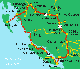
tour takes you to Prince
Rupert and the Queen Charlotte Islands,
just south of Alaska. Although it is by no means a
complete tour of Northern
BC, it includes some of the region's
most talked about coastal scenery and most impressive
historical and archeological sites.
Your
ferry departs from Port
Hardy, Vancouver Island's most northern
ferry terminal (391/245 miles north of Nanaimo
on Highway 19). You will want to plan to stay over
in Port
Hardy to allow for boarding time for
the next ferry.
 |
|
Off
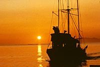
the shores or Prince Rupert.
Photo Courtesy of Northern BC Tourism
|
Bring
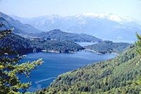
a camera for hours of spectacular views while sailing
past inlets, waterfalls and rain forests of the Inside
Passage. The ferry will stop at several
locations and the trip takes approximately 2 days.
Arriving
in Prince
Rupert, dine at one of the city's superb
seafood restaurants and take some time to discover
its many attractions. The Queen
Charlotte Islands are just a ferry
ride away, and offer an unlimited source of activities
and accommodations. Camp in Naikoon
Provincial Park (at the northeast end
of Graham Island), or take a guided tour of the area
(contact the Queen Charlotte City Chamber of Commerce
for information).
Heading
east from Prince Rupert, the Yellowhead Highway (BC
Highway 16) takes you through many friendly communities.
The totems at the Hazeltons
(287km/179 miles) are a definite must-see. Enroute,
the landscape changes dramatically travelling by rivers,
lakes, mountain rages and lush valleys.
 |
|
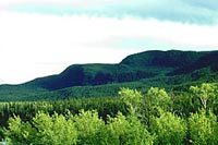
Nechako
|
Houston
(132 km/83 miles) is known throughout Canada for its
steelhead fishing. There are also several British
Columbia Forest recreation sites close to Houston,
as well as the Morice Mountain Ski Trails, which are
open to hikers during the summer.
Vanderhoof
(219 km/137 miles from Houston) is surrounded by hiking
trails. Fort St. James sits at the southern end of
Stuart
Lake, 54 km/34 miles north on Highway
27, next to two provincial campgrounds. Paarens
Beach Park offers fishing and is on
the provincial campground reservation service.
At
Prince
George (98 km/61 miles east of Vanderhoof),
head south on Highway 97 to return to Vancouver. Highway
97 will take you to Cache
Creek, where you have a number of routes
to choose from.
OPTION
I: The Lillooet-Sea-to Sky Highway
Take Highway 99 south at the junction with Highway
97 (11 km/7 miles north of Cache Creek). Follow the
road as it traces the Cayoosh River and escorts you
through lush valleys and mountain ranges. Stop at
Whistler
for a gourmet meal, or stay over in one of its highly
rated hotels or bed and breakfast homes.
 |
|
Fraser
River
|
Return
to Vancouver, taking time to capture a few pictures
of the coastal waters and the Gulf Islands beyond.
OPTION
II: The Fraser Canyon Route
Take Highway 1 south from Cache Creek. Stop at the
Ashcroft Manor
(5 minutes away) for lunch. Your journey south takes
you through the arid, high desert country of the north
Thompson and Fraser Canyons and BC's historic gold
trail, into the lushly forested terrain of the Vancouver
Coast and Mountain region. Lytton
is Canada's river rafting capital, and offers several
campgrounds with scenic lookouts that are accessible
to RVs. Stop in Hope
(approximately 192 km/120 miles from Cache Creek)
for a self-guided tour of this town's impressive chain
saw statues. This route is the quicker of the two,
but you will find plenty to investigate and explore
as you wind your way through the farming belt of the
Fraser
Valley.
Be
sure to browse the Points of Interest:
Read
a Travelog:
Check
BC Ferries Information
|

 NORTH
WEST BC TOUR


